|
|
MILTON AND THE BLUE HILLS - 1903 The quickest way to reach Milton is by a train on the Milton branch of the New York, New Haven & Hartford Railroad, leaving from South Station and reaching Milton station in about twelve minutes.
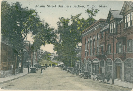
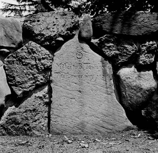
At the village known as Milton Lower Mills the Boston street-car system ends and other lines start out, — for Dedham via Hyde Park, and for Brockton via Randolph, connecting at both points with lines to other places. The chief industry of the village is the manufacture of chocolate, and the great stone-trimmed brick buildings of the Walter Baker Company cover a large space on both sides of the river and utilize its considerable water power. From the bridge one gets a view on the left of the slight falls; and in a rock rising above the water is set a bolt bearing a tablet with an inscription recording that the tide of April 16, 1851, reached the top of the bolt. This was the famous high tide of the storm which destroyed the Minot’s Ledge lighthouse, and was here about ten feet. 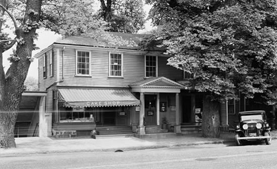 Only a little way beyond the bridge, on the Milton side, stands the “Suffolk Resolves” house, shaded by three venerable English elms, which has been called the “birthplace of American liberty.” It is a two-story yellow, double house, of which one half is now devoted to a watchmaker’s shop. Beside the pillared portico a marble tablet bears an inscription in antique Roman characters, relating the history of the Suffolk Resolves, which, adopted in this mansion by delegates from the Suffolk County towns September 9, 1774, “led the way to American Independence.” At the time of the convention the house was the mansion of Daniel Vose, owner of several of the industries of the town — his chocolate mills, founded in 1765, were the first in the colonies — and a zealous patriot. The convention was composed of delegates from the nineteen towns then comprised in Suffolk County, which also included all now embraced in Norfolk County. Paul Revere was the messenger who carried the Resolves to Philadelphia. Continuing up the gentle slope of Adams Street we pass several old time houses on either side of the road. One on the right, just where Canton and Randolph avenues branch off, was in early days the Rising Sun Tavern. Canton Avenue is the direct route by the Great Blue Hill to Canton, while Randolph Avenue cuts through the Blue Hills Reservation farther south, and continues on to Randolph and Brockton. A line of trolley cars (of the Old Colony system) diverging to the right lower down the slope, at Central Avenue, skirts the base of the hill, passes through Milton Center, and comes out in Randolph Avenue before reaching the Reservation, affording an easy means of arriving at this great pleasure ground. But there are reasons for prolonging our walk a little farther up Milton Hill, on Adams Street. All along the way are fine old estates which have been handed down from generation to generation of families noted in local — and some in national — annals. On the left side a pleasantly situated villa is the home of Mrs. A. D. T. Whitney, though her early home, in which her first works were written, was in Milton village. A few steps beyond, on the right, stands a house of modern exterior, well back from the street, in whose fabric is incorporated the historic house of Governor Hutchinson, his country seat. To this house he withdrew at the time of the closing anti-tea meetings in the Old South Meetinghouse in Boston; and it was from this house that he started on his final voyage to England in June, 1774, never, as it fell out, to return. It is gratifying to observe that the great field in front, on the lower side of the street, has been taken for a public reservation, as Governor Hutchinson’s Field, so that the lovely prospect is safe from the obstruction of buildings. 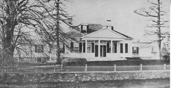 At the top of the hill the old Dr. Holbrook mansion, built in 1801, is noted for having been the scene of a brilliant entertainment to Lafayette during his last visit to America, in 1824. Beyond are the extensive estates so long associated with the Forbes family, — John M., the master spirit of the Chicago, Burlington & Quincy Railroad for many years; J. Malcolm, equally noted in connection with the American Bell Telephone Company; Captain Robert B. and J. Murray Forbes; also the fine country seat of the late Oliver W. Peabody of the Boston banking house of Kidder, Peabody & Co.; and farther on the summer place of his partner, the late Henry P. Kidder. At the old “Algerine Corner” — now commonplace Union Square — a road on the right diverges to the town center. At Otis Street, a little beyond, was, in provincial times, the estate of the royal governor, Jonathan Belcher, bought by him about 1728, and his country seat during his service of about eleven years. It was he who placed along the road to Boston the Belcher milestones, one of which is to be seen in the wall of [224 Adams Street] the Peabody place, bearing the legend “8 miles to B Town House. The Lower way. 1734.”
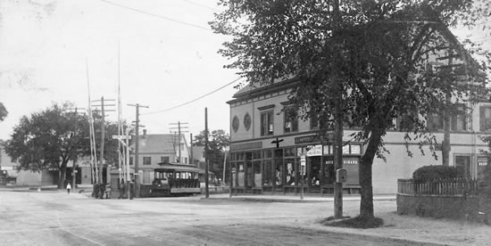
Adams Street continues through the square past East Milton, a half mile farther on, a bustling village, its trade having a granite foundation, — quite naturally, for it adjoins West Quincy, where are the quarries which give to Quincy the title of “the granite city.” We might prolong our walk to East Milton and there take a car to Quincy, only three and a half miles distant. It would be better, however, to look over the northern part of Milton and go to Quincy by another route. From Union Square, Centre Street runs “cross town” to Randolph Avenue, which we left at the beginning of our walk. By way of Centre Street a walk of some three quarters of a mile would bring us to the old Town Cemetery, where rest the forefathers of many present citizens, the oldest gravestone bearing date of 1687. The Ministerial Tomb is near the entrance, and has a quaint inscription setting forth that it is “to be, abide and remain forever” as such. The names of the first minister, Peter Thacher, who died in 1727, his wife Susanna, and several succeeding ministers and their families are inscribed on the upright slab. Near the middle of this burying ground is a monument which attracts the most attention. This is the granite boulder over the grave of Wendell Phillips and his wife. Phillips died February 2, 1884, and his body was first placed in the Phillips family tomb in the Old Granary Burying Ground, Boston, but after the death of Mrs. Phillips, two years later, it was removed hither. The inscription on the boulder was written by him and it attests the simplicity and the chivalry of the man: Ann and Wendell Phillips. Passing through the burying ground we emerge near Randolph Avenue, where stands the famous old Milton Academy, founded in 1805-1806. A little farther on, at White Street [Reedsdale Road], we reach Milton Center, or Milton Churches, as this section is more generally known, the group of buildings set in the pleasant square and shaded by lofty elms. The twin churches, as the local title goes, are the Unitarian (successor of the original First Parish Church) and the East Church (Evangelical Congregational), founded in 1834 when the great schism in New England theology took place. Between them stands the Town House and at one side the high school. A fine Public Library of brick with granite trimmings is near completion close by. 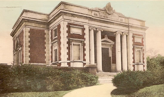 Here we may take the car which has come round through Central Avenue and now makes in a southeasterly direction for Randolph Avenue, which it follows for nearly a mile before the edge of the Blue Hills Reservation is reached. Through the Reservation it runs for nearly two miles. Crossing the range between Chickatawbut Hill on the left and Hancock Hill on the right, Great Blue Hill, away beyond Hancock, with the weather observatory and kite-flying station on its summit, being in plain sight for a considerable distance. From near the “twin churches” Thacher Street runs northwesterly for about a mile (past the site of the house built in 1689 by the Rev. Peter Thacher, the first minister of the town) to the Blue Hills Parkway (formerly Mattapan Street) of the Metropolitan system, which leads to the western (or Great Blue) section of the Reservation. 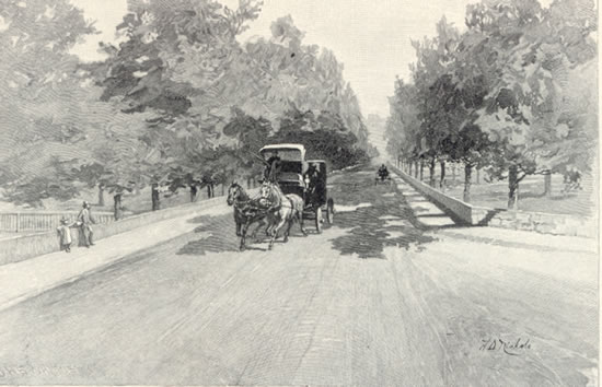 The trolley line, which runs through the parkway for a short distance, then, diverging south to Canton and Stoughton, furnishes a speedy means of reaching the Great Blue Hill. The car leaves one at a point where an easy foot path – cut through the woods from the old bridle path to the summit – emerges upon Canton Avenue.
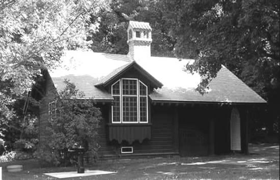
Blue Hill Avenue waiting station It is a pretty walk along the broad and shaded parkway to the river, which is spanned by a new stone bridge, built by the Metropolitan Park Board. Crossing it we are in Mattapan, whence we have a choice of ways for the return journey, — street cars via Blue Hill Avenue and Franklin Park, trains over the Milton branch from a station close by the river, or over the Midland Division at the crossing of Blue Hill Avenue. The Milton branch route takes us for two or three miles alongside, and twice across, the picturesque Neponset, whose shores are now protected by the Metropolitan Board, and amid whose wooded nooks one catches a glimpse of a rustic footbridge and the sheen of a little waterfall. -from Boston A Guide Book by Edwin M. Bacon, GINN & COMPANY, PUBLISHERS, The Athenæum Press, Copyright 1903 Images are from the collection of The Milton Historical Society
|